

A Surprising Defeat for Race-Based Scholarships
3 hours ago
Blogging, every once in a while, from the United States of Whatever!
 Is this a crop circle in the middle of Washington DC? No. It is Observatory Circle and where the residence of the Vice President is. Why blurry? I think I can make a guess.
  Please note: For the above picture (and all the others on this site) you can get a bigger and more detailed picture by clicking on the small picture presented here.
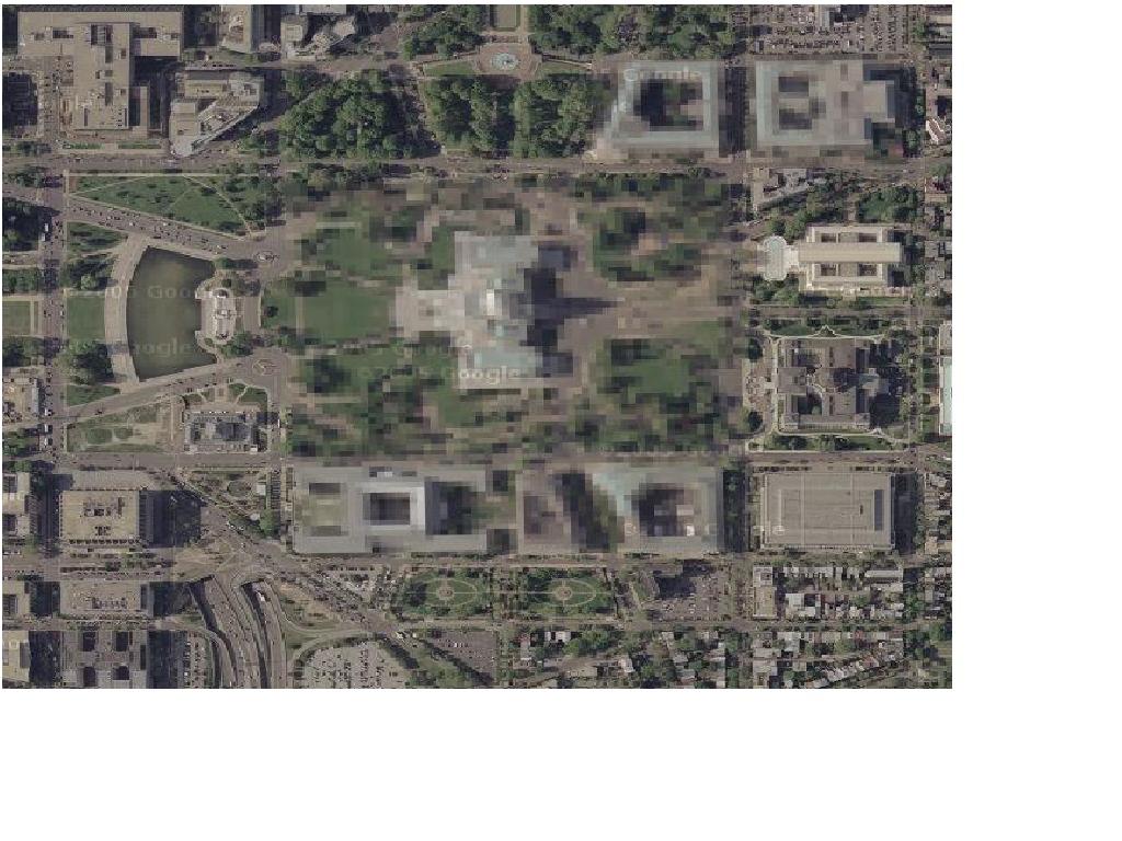
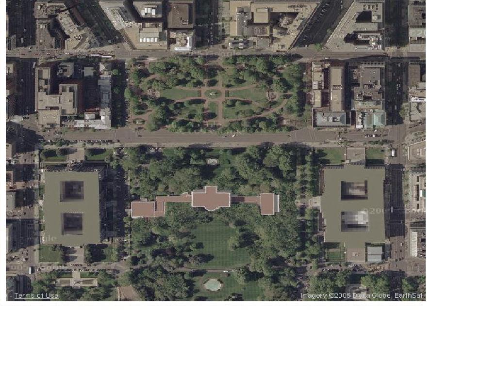 Do you see something odd about the roofs of the White House and the bldgs to either side? I do. Notice how all the other structures have complicated roofs? Lots of air conditioners and vents and stuff like that. The White house looks strangely uniform. Here the subtrafuge is understandable. No need for anyone out there to see the Patriot battery on the roof of the West wing!